Kurgan in Hubinek site 2 - Zabytek.pl
Address
Hubinek
Location
voivodeship lubelskie,
county tomaszowski,
commune Ulhówek
It is a unique example of a site with two overlapping burial mounds: the older one is associated with the Neolithic Corded Ware culture and the younger one is associated with a subsequent prehistoric period.
History
Archaeological excavations have shown that the earthen mound consists of two overlapping mounds, the older one should be associated with the Neolithic Corded Ware culture, the chronology of the younger one was more vaguely described as prehistoric.
Description
The barrow is located in the eastern part of the village of Kolonia Hubinek, approx. 350 m in a straight line to the north of its continuously built-up area and the Kolonia Hubinek–Ulhówek road. The mound is located at the top of a hump in the terrain, 200 m west of the mound marked in the village as site no. 1. It is situated in a field used for agricultural purposes.
During the field survey in 1993, the height of the mound was about 4 m and its diameter was 40 m. As a result of intensive plowing along the slopes of the elevated terrain, the mound had been obliterated to a significant extent and its height at the beginning of the archaeological excavations was about 1.5 m and its diameter was 50 m.
The barrow was well preserved until the 1990s. Currently, intensive plowing, which affects the entire site, causes progressive destruction and is a serious threat to the state of preservation of the object.
Progress and findings of archaeological fieldwork activities
The site was excavated in 2011 by Jolanta Bagińska and Jerzy Libera.
The situation and altitude plan of the site was drawn up by: Józef Niedźwiedź and Adam Medak in 1989 roku
The surface surveys as part of the AZP project (Archaeological Picture of Poland) on the site were carried out by: Wojciech Mazurek and Urszula Kurzątkowska in 1987.
The excavations focused on the western part of the burial mound, covering a semicircular area with a radius of 18 m and a surface of approx. 5 ares. 12 objects were discovered within the excavation trench, including: three graves with human skeletal remains, one grave with animal remains, two ditches around the burial mounds, a pit near the burial mound - the so-called clay pit, five objects (pits), the function and chronology of which have not been established. During the excavations, about 240 moveable artefacts were retrieved. The most important discovery was that the site contained two overlapping burial mounds.
The older earthen structure, with a centrally located grave with skeletal remains in a “side-back” position, with the head facing west, without any grave goods, but with a large amount of ocher in the burial pit, was surrounded by a circular ditch with a diameter of about 9 m.
-
 Hubinek site 2, Municipality of Ulhówek, kurgan, view from the south-east, condition as of 2010, fot. Ewa Prusicka
 -
Hubinek site 2, Municipality of Ulhówek, kurgan, view from the south-east, condition as of 2010 , fot. Ewa Prusicka
-
Hubinek site 2, Municipality of Ulhówek, kurgan, view from the south, condition as of 2010, fot. Ewa Prusicka
-
Hubinek site 2, Municipality of Ulhówek, kurgan, view from the south, condition as of 2010, fot. Ewa Prusicka
-
Hubinek site 2, Municipality of Ulhówek, kurgan, view from the east, condition as of 2010, fot. Ewa Prusicka
The younger burial mound, raised on the pre-existing one, had a mound of earth with a diameter of approx. 18 m, surrounded by another ditch enclosing the burial mound. In the southern peripheral part of the burial mound, two graves with skeletal remains were discovered. One contained skeletons of two children or adolescents and the other one contained the skeleton of an adult. The two graves did not contain any grave goods, however, traces of ochre were found. In the central part of the burial mound, there was a large pit 6x4 m in size and 4.15 m deep, containing single fragments of clay vessels. It is thought to be a looter’s trench dug out in modern times. On the west side of this trench, a grave was discovered with skeletons of two animals (a skeleton of a doe lay on top of a skeleton of an auroch) but with no grave goods. Interesting discoveries included traces left by poles of the encircling palisade in the ditch around the burial mound that had once surrounded the core part of the entire earthen mound. On the northern side of the earthen mound, traces were found of a large pit near the burial mound, the so-called clay pit, from which soil had been removed for constructing the burial mound.
In the eastern part of the burial mound, remnants of a shooting trench from the early modern period and prehistoric pits of unspecified chronology have been discovered.
On the basis of moveable artifacts, mainly in the form of fragments of clay vessels, the chronology of the older burial mound (lower) can be described as the second half of the third millennium B.C.E. and is attributable to the Corded Ware culture. The younger burial mound has been dated as prehistorical, without being specifically attributed to any culture.
Heritage site accessible to the general public.
compiled by Ewa Prusicka-Kołcon, National Institute of Cultural Heritage, Branch Office in Lublin, 11 April 2016
Bibliography
- Machnik J., Bagińska J., Koman W., Neolityczne kurhany na Grzędzie Sokalskiej w świetle badań archeologicznych w latach 1988-2006, Krakow 2009.
- Bagińska J., Libera J., Wstępne sprawozdanie z badań wykopaliskowych stanowiska 2 w miejscowości Hubinek, gm. Ulhówek, pow. tomaszowski, woj. lubelskie, Tomaszów Lubelski – Lublin 2011, typescript in the archives of the Voivodeship Office for the Protection of Historic Monuments in Lublin, Branch Office in Zamość.
- Banasiewicz-Szykuła E., Gołub I. Koman W., Mączka G., Zieniuk P., Sprawozdanie z działalności w zakresie ochrony zabytków archeologicznych na terenie województwa lubelskiego w 2011 roku, “Wiadomości Konserwatorskie Województwa Lubelskiego”, 2012, vol. 14, pp. 27-28.
Category: sepulchral site
Protection: Register of monuments, Monuments records
Inspire id: PL.1.9.ZIPOZ.NID_A_06_AR.3278, PL.1.9.ZIPOZ.NID_E_06_AR.2511998
Browse documents
9 documents
-
KEZA
2KEZA
-
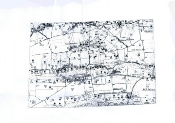
mapa obszaru AZP 1:25 000
3mapa obszaru AZP 1:25 000
-
mapa inna
1mapa inna
-
spis stanowisk wg numerów na obszarze
4spis stanowisk wg numerów na obszarze
-
sprawozdanie z badań
1sprawozdanie z badań
-
spis stanowisk wg numerów na obszarze
4spis stanowisk wg numerów na obszarze
-
spis stanowisk wg chronologii i funkcji
2spis stanowisk wg chronologii i funkcji
-
inna
1inna
-
rysunek/fotografia zabytków ruchomych
2rysunek/fotografia zabytków ruchomych


Objects in this area
10 objects
-
Add to favorites Go to the subpage of the object Barrow in Hubinek – site 1
Created by NIDHubinekBarrow in Hubinek – site 1
-
Add to favorites Go to the subpage of the object ślad osadniczy, st. 17
Hubinekślad osadniczy, st. 17
-
Add to favorites Go to the subpage of the object stanowisko archeologiczne, st. 20
Hubinekstanowisko archeologiczne, st. 20
10Show all