Barrow in Hubinek – site 1 - Zabytek.pl
Address
Hubinek
Location
voivodeship lubelskie,
county tomaszowski,
commune Ulhówek
What makes it different from other mounds is its location at the top of a raised area of land and fairly good state of preservation.
Location and description
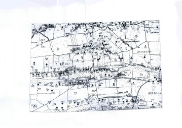
The barrow is located in the eastern part of the village of Kolonia Hubinek, approx. 350 m in a straight line to the north of its compact complex of buildings and the Kolonia Hubinek-Ulhówek road. The mound is situated at the top of a hump and forms an elevation point of 245.37 m above sea level. It is sited on a field used for agricultural purposes and in the immediate vicinity of an unpaved road. Based on the findings from these reconnaissance carried out in 1993, researchers determined that the mound had measured approx. 6 m in height and approx. 50 m in diameter (currently, it is about 3.0 m in height and the same in diameter). The burial mound has been largely levelled by ploughing; its eastern part was slightly damaged by demarcating a dirt road; only the central part is protected by a wasteland over a small area of land, where the elevation point is situated.

History
The structure dates back to prehistory. Until the 1990s, the barrow was in a good state of preservation. Currently, intensive ploughing by which almost the whole site has been affected leads to progressive degradation and poses a serious threat to the state of preservation of the structure.
Condition and results of archaeological research
The site has not been subject to excavations so far. The location and height plan of the site was drawn up by Jan Niedźwiedź and A. Medak in 1989. Surface surveys of the site within the framework of the ‘Archaeological Picture of Poland’ project were carried out by W. Mazurek and U. Kurzątkowska in 1987.
Limited access to the monument. Viewing of the barrow is only possible by arrangement with the owner of the field. The burial mound is easily visible from the unpaved road open to general public.
Compiled by Ewa Prusicka-Kołcon, Regional Branch of the National Heritage Board of Poland in Lublin, 24.07.2014.
Bibliography
Gurba J., Wojtanowicz J., Problematyka kurhanów i cmentarzysk kurhanowych na Grzędzie Sokolskiej, [w:] Przewodnik XII Ogólnopolskiego Zjazdu Polskiego Towarzystwa Geograficznego, Lublin 1974, pp. 57-61, fig. 16
Machnik J., Bagińska J., Koman W., Neolityczne kurhany na Grzędzie Sokalskiej w świetle badań archeologicznych w latach 1988-2006, Kraków 2009.
Category: sepulchral site
Protection: Register of monuments, Monuments records
Inspire id: PL.1.9.ZIPOZ.NID_A_06_AR.1486, PL.1.9.ZIPOZ.NID_E_06_AR.2511902
Browse documents
9 documents
-
KEZA
2KEZA
-
mapa obszaru AZP 1:25 000
3mapa obszaru AZP 1:25 000
-
mapa inna
1mapa inna
-
spis stanowisk wg numerów na obszarze
4spis stanowisk wg numerów na obszarze
-
sprawozdanie z badań
1sprawozdanie z badań
-
spis stanowisk wg numerów na obszarze
4spis stanowisk wg numerów na obszarze
-
spis stanowisk wg chronologii i funkcji
2spis stanowisk wg chronologii i funkcji
-
inna
1inna
-
rysunek/fotografia zabytków ruchomych
2rysunek/fotografia zabytków ruchomych


Objects in this area
10 objects
-
Add to favorites Go to the subpage of the object Kurgan in Hubinek site 2
Created by NIDHubinekKurgan in Hubinek site 2
-
Add to favorites Go to the subpage of the object ślad osadniczy, st. 84
Podlodówślad osadniczy, st. 84
-
Add to favorites Go to the subpage of the object ślad osadniczy, st. 17
Hubinekślad osadniczy, st. 17
-
Add to favorites Go to the subpage of the object stanowisko archeologiczne, st. 20
Hubinekstanowisko archeologiczne, st. 20
10Show all