Barrow - site 2 - Zabytek.pl
Address
Typin
Location
woj. lubelskie, pow. tomaszowski, gm. Tomaszów Lubelski
What makes it different from other mounds is its location at the top of a raised area of land and fairly good state of preservation.
Location and description
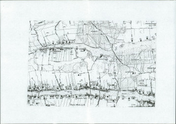
The barrow is located in the south-eastern part of the village, about 1 km in a straight line to the north of the eastern edge of the village of Typin and approximately 200 metres to the east from the boundary of the Bukowiec forest. It is situated on the crest of a section of the terrain with an elevation of 288.12 metres above sea level, in the fields which continue to see active use as arable land. The site of the barrow is intersected by a dirt road.
The barrow is clearly discernible in the surrounding terrain. Only the north-eastern part of the burial mound has been preserved in a good condition; today, this part of the mound is a deserted piece of land overgrown with a few dozen trees (birch), with tall grass covering the ground during each summer. In addition, the site is also home to a wooden deer stand. The north-western and south-western sections of the mound have been substantially levelled in the course of agricultural use of the land and the construction of the local road; the south-eastern part has not been levelled to the same degree as the two sections mentioned above, although ongoing tillage continues to threaten its existence. The height of the preserved north-eastern part of the mound is approx. 3.5 metres, with the radius calculated at its base amounting to about 10 metres. Based on the findings from these reconnaissance carried out in 1973, Andrzej Hunicz determined that the initial dimensions of the mound were approx. 8 m in height and approx. 50 m in diameter.
-
 Typin, site no. 2, Tomaszów Lubelski commune, burial mound, view from the south, condition as of 2010, photo by Ewa Prusicka
 -
Typin, site no. 2, Tomaszów Lubelski commune, burial mound, view from the south, condition as of 2010, photo by Ewa Prusicka
-
Typin, site no. 2, Tomaszów Lubelski commune, burial mound, view from the south, condition as of 2010, photo by Ewa Prusicka
-
Typin, site no. 2, Tomaszów Lubelski commune, burial mound, view from the east, condition as of 2010, photo by Ewa Prusicka
-
Typin, site no. 2, Tomaszów Lubelski commune, burial mound, view from the east, condition as of 2010, photo by Ewa Prusicka
-
Typin, site no. 2, Tomaszów Lubelski commune, burial mound, view from the east, condition as of 2010, photo by Ewa Prusicka
-
Typin, site no. 2, Tomaszów Lubelski commune, burial mound, view from the east, condition as of 2010, photo by Ewa Prusicka
-
Typin, site no. 2, Tomaszów Lubelski commune, burial mound, view from the east towards the preserved northern section of the mound, condition as of 2010, photo by Ewa Prusicka
History
The mound is believed to be a relic of the late-Neolithic Corded Ware culture.
The very first mentions of the burial mound appear towards the end of the 19th century in the “Geographic Dictionary of the Kingdom of Poland and Other Slavic Countries”, where it was described as a great barrow known as the “Swedish barrow”, located near the forest in Typin. Until the middle of the last century, the mound remained in a good condition. Today, unfortunately, the intense agricultural activities on the north-western, south-western and south-eastern parts of the mound as well as the presence of a local road intersecting the mound along the north-south axis result in the gradual destruction of the site and continue to pose a serious threat to its very existence.
Condition and results of archaeological research
The site has not been subject to excavations. The location and height plan of the site was drawn up by J. Niedźwiedź and A. Medak in 1989. Surface surveys of the site within the framework of the ‘Archaeological Picture of Poland’ project were carried out by J. Buszewicz, R. Pomarański and J. Waszkiewicz in 1988.
Unlimited access to the historic structure. The burial mound is easily visible from the unpaved road open to general public.
compiled by Ewa Prusicka, Regional Branch of the National Heritage Board of Poland in Lublin, 13-01-2015.
Bibliography
- Machnik J., Bagińska J., Koman W., Neolityczne kurhany na Grzędzie Sokalskiej w świetle badań archeologicznych w latach 1988-2006, Cracow 2009.
- Nosek S., Materiały do badań nad historią starożytną i wczesnośredniowieczną międzyrzecza Wisły i Bugu, “Annales UMCS, vol. VI, sec. F, 1951, p. 379.
- Słownik geograficzny Królestwa Polskiego i innych krajów słowiańskich, F. Sulimirski (ed.), vol. 12, Warsaw 1880-1895, p. 717.
Category: sepulchral site
Protection: Register of monuments, Monuments records
Inspire id: PL.1.9.ZIPOZ.NID_A_06_AR.3328, PL.1.9.ZIPOZ.NID_E_06_AR.2211636
Browse documents
6 documents
-
KEZA
2KEZA
-
mapa obszaru AZP 1:25 000
1mapa obszaru AZP 1:25 000
-
mapa inna
1mapa inna
-
sprawozdanie z badań
1sprawozdanie z badań
-
spis stanowisk wg numerów na obszarze
3spis stanowisk wg numerów na obszarze
-
spis stanowisk wg chronologii i funkcji
1spis stanowisk wg chronologii i funkcji


Objects in this area
1 object
-
Add to favorites Go to the subpage of the object Kurgan-type grave field in Wola Gródecka, site 13
Created by NIDWola GródeckaKurgan-type grave field in Wola Gródecka, site 13
1Show all